Video:


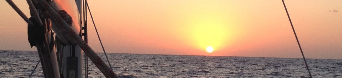
We left Baie de Marigot around 9.30pm on March 31st. The forecast was of light Easterly winds, and light they were, straight on our back. The forecast indicated the breeze would veer slightly SE, so we left on a starboard tack with a poled out Genoa, heading north of the rumb line to gybe once the wind would turn SE. The forecast happened to be quite accurate and with the gybe we managed a seagull shaped track on the chart, with the gybe bringing us straight onto Virgin Sound pass (north tip of Virgin Gorda).
We knew this was as far north as our little trip will bring us. Some 2,000nm have been covered in the Lesser Antilles since we arrived in mid December, you can see a chart with the main waypoints. The Virgin Islands were far away in our minds when planning at home with the charts spread on the floor, but now we are there.
The BVI are made of 3 main islands – Anegada, Virgin Gorda, Tortola and Jost van Dyke – and a series of smaller islands – Peter, Salt, Cooper and Ginger Island. All in all, you can picture it as an oval SW-NE, with Anegada being the outlier farther North. It makes limited sense to make many plans about visiting the place in a given order, except maybe for Anegada (more so because the approaches need care i.e. good visibility), and we rather decided the next anchorage (or mooring, as it is not always possible to avoid the buoys) around a drink the evening before depending on swell direction, diving / snorkeling spots or specific “must be seen” bays.
Virgin Gorda
Our trip from St. Martin brought us to Virgin Gorda, where we wanted to visit Gorda Sound, Eustatia Sound and the unmissable Baths. Virgin Gorda, or the Fat Virgin, so named because of its profile. There should be a couple of hints to history here, but time is starting to be of the essence (the rest of the family leaves at once in a week time) and we will skip it.
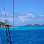
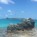
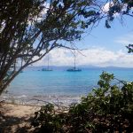
As one sails due West through the Virgin Sound Pass, he / she will get to see Necker Island on starboard. It is probably not a coincidence that Sir Richard Branson chose the place to buy a couple of islands, including Necker. By the way, it appears that the solitary 3 palm trees standing on the sandy patch are not strictly natural (to be checked, maybe they replace the originals damaged in a hurricane?). Necker Island looks beautiful, but it was not clear to us weather we could anchor and then land, so we headed straight into Gorda Sound.
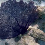
It is a large lagoon with a main pass and a secondary pass. It is totally protected, with anchorages all around and few reefs compared to other areas. Talitha, which is a shallow drafter chose the far less obvious and more beautiful pass into Gorda Sound that lies between Prickly Pear and Bitter End. There was diverging information as to the depths and positions of the underwater rocks between paper charts, pilot books and electronic charts, but my paper chart said 1.8m, which is a no go. The reality is that there actually are depths of about 2.5m, but this is outside the buoyed channel, which itself is a trap since the only true danger, an almost awash rock is right in the center of it. With a good lookout at the bow they got around it, but it will be duly reported to the authors of the pilot book.
We all took buoys at Biras Creek as the electronic charts (not the pilot books) said one could complete clearing formalities there. Wrong information (and surprisingly the mistake is known to the nearby marina, but for some reason has not been corrected), and we were soon on Talitha’s dinghy for a mile long ride to Gun Creek for clearance. We arrived well before close of business, but it was closed anyway. Ride back empty handed, and it was too late to move to another anchorage so we hanged onto our buoys.
Next morning 8 AM we were given a visit by a nice chap with one hand on his fishing line. Boat boys selling the morning catch in the BVI? Nope, he was collecting the mooring fee. We rarely know which day of the week it is, but in this case I remember it was a Sunday as the clearance charges at Gun Creek bore an overtime premium. We were also quite happy to be working on four layers of carbon paper again, rather than those funny computers, who needs them anyway.
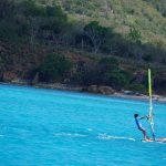
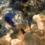
That day we anchored on the Eastern side of Gorda Sound, between Cactus Reef and Vixen Point. The next short hop was outside lagoon and into Eustatia Sound, the 3 boats choosing to use the main pass and with the kind lead of Talitha to sound the depths ahead of the fixed keelers. We anchored on the lee of Eustatia, on 4 meters of white sand, turquoise water, a deserted beach waiting for us. But we are still too young to spend our precious time on a beach, and all boys were soon windsurfing, that is after having completed schooling duties of course.
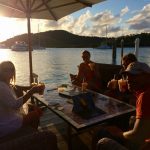
In the afternoon we went for an appero at the Saba Rock island, which is as large as the bar / restaurant that occupies it. Happy hour begins at 16.30 and runs for two hours, and we managed to squeeze one drink before, and the 2nd right after. Interestingly the earlier is served in plastic cups, whereas the full price version comes into a glass. The content is pretty much the same, but we did not care anyway as the six of us were just having a peaceful moment facing sunset and making projects of opening a restaurant / sailing school (and other, more original options) in the area.
The place was crowded with the pleasant crew from the many boats at anchor at Bitter End, and here’s one note that works for all the BVI: Many charter boats move in groups, as if they have designated routes / anchorages as well as no-go areas, and a daily log to follow. Eustatia, which is closer to paradise than Bitter End, was empty as it is not visited by charters, whereas the later was packed. The same happened in many places, most significantly at Anegada where we were literally alone at anchor behind Palmeto point (true, you need approach it slowly and with sharp eyes) whereas Setting Point hosted no less than 100 masts and an incredible daily turnaround. Also, sailors here do wake up early, and what was a packed anchorage at night is half empty at 8 AM. You need to be 10AM latest in the coveted places to get a decent chance of finding a buoy / safe anchorage. The exception may be the Baths, by far the best known / more postcard-picture spot in the BVIs. Here, the technique involved arriving i) on a Saturday (return date for most charters) and ii) 4 PM. We had the baths to ourselves, just how nice is that.
Anegada
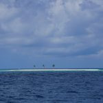
Anegada is the northernmost island of the BVI, some 12 nm from Eustatia. The “drowned” island is flat, the highest point being 8-9m above seas. If you approach at night you will park your boat there or on the reefs before it.
It was initially off our plans, as the approaches are dotted with uncharted coral heads and the main anchorage is quite shallow. There is a 2nd anchorage, off Palmetto Point, but on paper it seemed exposed. Anyway, the weather was perfect for sailing, around 20kn on a reach and not much swell, and we decided we could always head back to Eustatia and still call it a fine sailing day. We put our sails down about 2 miles off the south shore of Anegada, where the “incompletely surveyed area” begins and proceeded slowly thereafter. On approach we could see that Setting Point had been invaded, whereas there was just 1 mast at anchor at Palmetto. For us, eyeball navigation by itself was not that useful: entire patches were switching from dark to clear water courtesy of the overcast day, and the surrounding depths are shallow for miles, with no visible rock or breaking reef as reference. Better select a waypoint on your chart and then follow a safe course with an eye on the sounder and two ears on the crew at the bow. We stopped some 250 meters offshore, on 3.5m of water. Talitha and Wind4Life got somewhat closer, but not that much.
The female members of the crew went to inspect Setting Point for a potential outing that night, but it is not feasible to get there unless you walk along the paved road, and it is not thinkable to use the dinghy at night as the reefs are awash and extend quite far from the shore.
So we spent a good evening at Wind4Life with 8 kids left at their own on Talitha. This is where a second dinghy related episode starts. The kids were aware enough to notice that the dinghy attached to W4L (not ours…) was missing, and called over the VHF. After the initial puzzlement, we could only confirm that indeed, W4L’s dinghy had parted company….when? well, in the last couple of hours as we were having our evening refreshments (that is the official name now) and dinner. It was past 10 pm as we ventured on a dinghy with a powerful torch light for MOB search or night landings. We followed the wind direction, the most probable path of the fugitive, for about a mile with great care not to get stranded ourselves on a coral head. Our boats were no longer visible and we decided it was prudent to return, although rather downwind of the initial path. I guess none of us was expecting to get lucky, but suddenly there it was, a further 50-75m to our left, shining under the beam of the torch! We called over the VHF to get a round ready….the image of the return ride on two dinghy’s at night will stay with me. What a relief for all, and how much fun. But we still decided to apply the general rule “everyone tie their own dinghy”
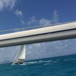
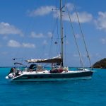
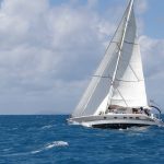
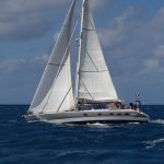
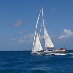
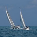
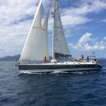
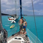
The next day we had a very nice sail back to Eustatia, as we wanted to spend another night in the anchorage. This is when the latest pics of Keraban under sail where taken, courtesy of Wind4Life and Talitha. Wind was 50-55 degrees real and between 20 and 25kn, 1 reef on the main, no ballast.
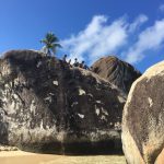
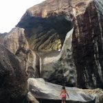
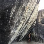
Virgin Gorda – The Baths
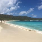
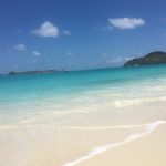
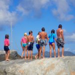
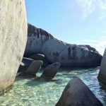
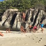
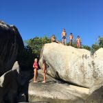
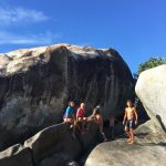
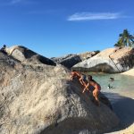
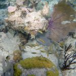
The next stop were the famous Baths, a massive stony formation on the southern tip of Virgin Gorda. It is very publicized on pilot books and else, but we were equally concerned of finding ourselves in a very crowded anchorage. We decided the best chance for a relaxed visit was to get there Saturday late afternoon, as most charter boats have to return to their base that day, and new clients depart Sunday. It worked, we found our mooring buoys immediately, and spent the late afternoon and evening alone at the Baths. The kids went their own way up and down the rocks, in the caverns and so on, no way we could keep them with us, these “sauvages”.
Cooper Island – Salt Island
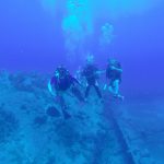
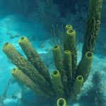
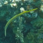
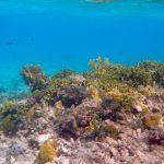
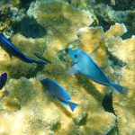
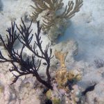
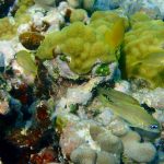
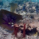
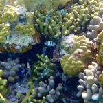
From Virgin Gorda we made a short hop to Cooper Island. There are good diving sites there, including two wrecks – Marie L and Pat – on Cooper Island and the famous wreck of the RMS Rhone at dinghy distance on Salt Island. Machionel Bay, the best protected anchorage, was full. W4L and Keraban anchored in the less protected but more picturesque Haulover bay on the SW of Cooper, whereas Talitha decided to head to Peter Island for that night. Dropping the anchor on sand as opposed to over or nearby the many rocks that are waiting to foul your anchor implied several anchoring attempts /check dives.
Finding the 2 wrecks was no simple feat. We had introduced the GPS coordinates on our portable GPS and ventured out on the dinghy, but as the weather was overcast and the wrecks lie under 20-30m of water, we were uncertain about their exact location. Anyway, thanks to the experience and freedive skills of Nico we found the right spot and made a nice dive with Nico, Yael and Yanic.
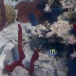
Next morning we moved early towards Machionel in search for a less rolly anchorage. We refilled our diving tanks at the local dive shop and went to dive over the RMS Rhone. The Rhone was a Royal Mail ship that sunk in 1867 trying to escape from a hurricane with a loss of 123 lives and that of some of Salt Island’s villagers during their efforts to save the passengers. We did not hear the voices that apparently haunt these waters, but the wreck is impressive nevertheless as the remains of the near 100m vessel appear before you suddenly, scattered in 3 main blocks. I keep thinking of Yanic, and how this very young fellow is already handling and enjoying such dives. The younger generation are far more mature than we were, at least the ones I am meeting of late.
Norman Island
The next bus stop was Norman Island. The distances between the small islands south of Virgin Gorda are short, we seldom set sail and rather motor, typically about half to one hour from one place to the other. It takes over an hour to hoist the sails and bring them down / store them properly…You would rather have a Hobbie Cat here and enjoy the flat seas and constant breeze.
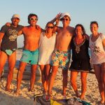
We took a mooring buoy at The Bight, the main anchorage at Norman Island, also known for the replica schooner Willie T lying there, where you apparently can spend some wild evenings. But before we tried that we were on a a nice afternoon at the local beach bar and the generous shadow it provided, planning what would come next. The calendar was getting tighter for those who wanted to venture to Puerto Rico and possibly the Bahamas, especially if a return to St. Martin was on the plans to pick up the crew for the Atlantic passage back to Europe. Les Têtus did not face that dilemma, as we are returning a good 3 weeks before our travel soulmates and the Virgin Islands represent our northernmost stage. It does feel short, believe it or not, and somewhat incomplete.
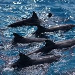
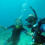
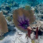
We had a rather pleasant outing at the Willie T, a couple of Austrians jumping from the roof top into the sea, a Spanish 60+ year old flirting nicely with our ladies and us putting a good laugh at it. Nice, but not a must. From the Bight we took our dinghies in the morning to go snorkel at the Caves. I took the diving equipment and, as usual now, Linda just went under with me on my secondary breather. If I left her alone she would go farther and deeper totally at ease. Looks like we have a future pro diver. Anyway, it was the 2nd dive in a row where we found small treasures: the first time around was a good diving knife, brand new, at the RMS Rhone, and this time a Silicone mask. That same evening we went for the nearby Benures bay, a secluded and solitary anchorage. We had one of those rare nights with no wind, the sea flat as a mirror. A full night sleep with no watch and checks remains a rare bonus. The kids making noise around us in the late afternoon were a joy to watch, until they saw what seemed like a solitary dolphin….or was it a shark?
From Benures we motored early in the morning to Pelican Island, another diving / snorkeling spot about 1 miles off Norman and on the way to Sopers Hole at the southern tip of Tortola. I made the mistake of launching my anchor buoy. That thing looks too much as a (very very small) mooring buoy and several boats raced with the hook ready to get my buoy….”how lucky are we, here’s the last available one for us”….I had to stay on watch and, no disappointment, at least 4 boats made the attempt (at Jost Van Dyke we decorated the buoy with a diving mask, it looks like a Minion by now, as well as a message saying “DO NOT TOUCH”, but we still saw more than 10 boats racing to get it, even fighting with each other as to who got there first, for the general amusement of the rest of the anchorage. Shame I did not film that).
Jost Van Dyke
I will skip our stay at Sopers Hole (Tortola), save to say that the marina has a good supermarket and a couple of good stores for goodies (e.g. we are collecting caps of every location we visit. My present favorite bears a valid script that reads “the beatings will continue until morale improves”).
So, to Jost Van Dyke now. As for other islands and channels in the VIs, the place is named after a (Dutch) pirate. It’s been our most enjoyable in the BVI, both for the beauty and the good times. It is only 3 square mile, but is gifted with a couple of small islets on its Eastern tip (smallest 1 lap = 90 secs), a couple of very nice anchorages (Great Harbour and White Bay) and a place called the Foxy’s which deserves all its reputation and more.
We enjoyed Easter at Sandy Cay and then Green Cay. The boys decided they would spend the night by themselves on Sandy Cay. Yes they asked permission, but that was just a formality since they seem to own the dinghys. Not much of a risk, but there was a watch on VHF nevertheless and, as someone saw torchlights at 3 AM the crew on the 3 boats were already excited. So, we took a dinghy and quietly landed on the Island. The kids spotted a dinghy on the beach, but not the occupant, and were quite scared for a moment….. I think it is one of those moments they will remember for long, even if they only slept maybe 1 hour and were quite morose the next day.
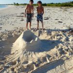
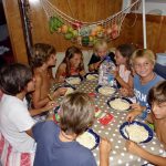
Indeed, next day was Easter and everyone, boys included, had been busy painting eggs which were hidden on the small island for a treasure hunt. 19 eggs to be precise, and all were found on time for a brunch onboard. How nice were those moments. This is when you know the trip has been more about the people than the places.
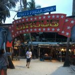
After an alcohol free Easter (we still managed a refreshment feet in the water at Green Cay) we were fresh and ready for the Foxy’s at Great Harbour. The beginning was difficult as we had to circle for about 2 hours before we could throw our hook half decently, only to find another gentlemen doing the same far less decently and too close for anybody’s taste except his. But for the rest, what a place. I guess I can not write anything new about what has been coined as one of the top three spots to spend New Year’s eve, but it is certainly very genuine and we hope it will stay like that for a long time. Don’t ask me to describe the evening there, we started at 5 pm and ended 3 am on someone else’s catamaran….. I also remember our favorite drink was the “wreck on the rocks”, and if we meet maybe I will tell you why. Just don’t have to be superstitious. We even managed to meet Mr. Foxy Callwood next morning for a charming chat on about how he met the Queen, his ocean crossings, his trips to Switzerland…..
From Great Harbour we went to explore White Bay next door. We knew it was a tight and shallow spot, with less than 4 m in general and several spots with less than 2m, reefs and so on. The entrance is normally marked by a pair of buoys, but as we arrived they seemed inverted (i.e. like in Europe for once), and the entrance so narrow I would have had a hard time getting through it on a bicycle. Indeed a catamaran bypassed the channel altogether…but then the last one I saw doing that ended on a reef at Le Marin in December. It was also blowing at times, which was going to make on the spot maneuvering difficult (no bow thruster on Keraban and a good 6 meters between prop and rudder). Talitha went ahead to sound the depths, and W4L followed, very generously grabbing a buoy for us to take, the only with enough water under it. I was in a “should I stay or should I go” state of mind, rather the later, and as some were already saying “I will understand if you opt out” we threw our heart (and bow eyes) at it and went ahead. We got through the entry channel buoys at dead slow speed as we knew something was wrong with that already (as we later discovered, the starboard buoy had slipped and was obviously on the wrong spot). W4L freed “our” mooring buoy and we started to maneuver tightly on the spot to avoid going into shallower areas. It was quite a moment, the boat refusing to turn, the waves breaking on the reefs 30m away and, of course, a catamaran faking it was not clear we were about to take that buoy. He must have genuinely guessed we got there for the fun of turning the boat between a rock and a reef.
W4L also had a moment as captain jumped off the boat and touched the bottom with his feet….really not much water then, 20cm below the keel at most. Not a surprise, but the rock he then discovered lying on the keel’s path was a real concern and they quickly switched spots with Talitha which can lift her keel. After all the effort, we only stayed a couple hours as the day was grey, the surf like breaking waves too close for comfort….
Back into Sopers Hole, the next morning the Talitha’s and W4L’s took the ferry to nearby St. John’s to get their visas for the US territory, and I took the morning to open Keraban’s rudder mechanism for cleaning and greasing.
Tortola – Garden Cay
With W4L and Talitha’s people back from the US, we went for Garden Cay on the West coast of Tortola. Although rumb line was maybe 3nm, we all felt we should enjoy the breeze and hoisted our sails. There were lying all the ingredients of a little regatta and it was good fun, fantastic memories of our boats, appropriate VHF messages as we made our first tack not that far from the Foxy’s at Jost Van Dyke…..
Garden Cay is surprisingly pleasant. A large bay, a flat wide beach with thin and tall palm trees and just enough life to feel comfortable but not overwhelmed. A perfect last evening.
This is the end of it, and it comes abruptly, fare more abruptly than 1 sentence. 1 instant you have 9 friends with you, the moment after we are gone. The last anchorage, the weight of a lifetime experience coming to a turning point….the next morning we were going to head our way back to St. Martin, the Talithas and Wind4Lifes towards Puerto Rico.
Passage from BVI to St. Martin
It is well known that sailing from the BVI to St. Martin is not a pleasant leg, as you are going against 1-1.5kn of general NW going current and at best a close haul….to Guadeloupe. The only valid “tactic”, waiting for a Northerly wind is more a wishful thinking in this period of the year when the winds starts to veer south of East, so E was all we got and were thankful for that.
The rumb line is only 77nm, but we covered 140 to get to Marigot Bay. The speed was less than satisfactory and we were barely managing 110 degree tacks when we are typically good for 90 and even less than that. But it was good training….We were slowed by sargasses (large algae that wrap around your keel, your propeller, and in my case the hydro generator) and had to tack / gybe several times to get rid of them. For some reason our maxprop propeller refused to fold. I had told you crew, the last leg was to be like this, but they are all very sturdy by now, a reliable team…. we got to destination and did not succumb to the temptation to make a stop at Saba to the south or to motor out our way. It did feel like a return trip though.
It’s been happy times. The family boarded a plane to Europe today as I post this, and I headed back to a silent Keraban at anchor at Grande Case. The lady at the airline desk was quite unfriendly, it’s raining and blowing hard tonight, it could not be otherwise.
We have been every hour of every day together since November, what a gift. Will they handle getting back to school in less than 36h? I would not but they will, I also trust they will keep their Hawaianas on for long! We will be meeting our friends soon enough to.
Dinghy License for all !!!!!