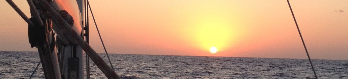
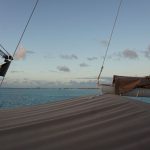
Deshaies to English Harbor is a 42nm sail, open to the ocean. We had the usual 22-25kn of wind, beam to broad reach, which is the crew’s and Keraban’s favorite angle. We did use the ballast for extra comfort and speed, the boat constantly above the 9kn mark and often into double digit.
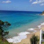
Antigua is the largest and possibly best known of the British leeward Islands, 14 miles long and 11 wide, and now that tourism has become key to the economy, is known for having 365 beaches, yes, one for each day of the year. Beyond such banners however, lies one of the islands with the most accessible and best maintained colonial architecture (Nelson’s Dockyard, in English Harbor), and some very well protected natural harbors in the south (English Harbor, Falmouth) and West (Nonsuch bay). It has also a relatively large main city, St. John’s, with some 20,000 inhabitants.
Columbus named the island after Santa Maria de Antigua, a Saint from Seville, when it discovered it in 1493. As we tend to forget though, the place had long been inhabited by the Arawaks and shortly after by the man-eating Caribs. Well before all of them, as early as 4,000 years ago, there had been the Ciboney Indians, who had disappeared and left the land empty for centuries.
The British settled in Antigua in 1632, but as in the majority of islands in the region, long battles ensued both with the Caribs and with the competing colonizing powers. Of all, the competition with the French across the region left the deepest imprint, leading the British to make out of English harbor a strategic naval base. The famous Horatio Nelson (which we had crossed for the first time in Gibraltar as the legendary Admiral Nelson) was in charge of controlling that all trade was carried by British vessels, and of inflicting sanction against enemies. So strict was he, that even his countrymen had rather had a more complacent law enforcer. Not sure if I had already told this story, but Nelson carried a large baric of rum in case he would die far from home (many soldiers did, mostly of yellow fever), such that his body could be preserved for transportation to Britain. Upon his death, his soldiers actually brought his body back home in a rum baric, and the myth goes that they drunk the rum from it in the belief that it would give them eternal strength. As in many islands of the region, the end of slavery marked the start of economic decay up until the 20th century, and it was not until the development of tourism that poverty and even violence where subdued.
Antigua finally became independent in 1981, after having first obtained self-government in 1967. Since, it has strongly developed tourism. But that is still in relative terms to their own past, as there is none of the large and ugly resorts to be seen, and not much other than nature outside the few towns.
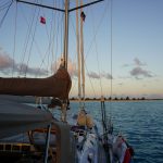
Our intent was to find a spot to anchor at the entrance of English Harbor such that we could visit Nelson’s Dockyard by dinghy. When arriving from the South, or from anywhere actually, the entrance is hard to spot. You rather need to follow landmarks and, if large yachts are anchored, their masts, to get there. Once inside, the swell disappears and you understand why the spot became a naval base. Unfortunately the channel, which has space for anchorage, was full and we were soon back under engine towards Falmouth harbor, a much larger but equally protected bay less than 1 mile West. It is dotted with shoals, but as long as you have a good watch and the sun is high they are easy enough see.
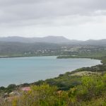
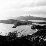
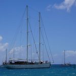
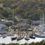
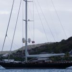
English Harbor and Falmouth are separated by a narrow stretch of land, and seen from some height they form a beautiful double bay. Both host some of the largest and prettiest sailing boats we have witnessed, and the same goes for motor superyachts (well, maybe not the pretty part). Some of the sail boats we were going to get the chance to see at full tilt a few days later at the Bucket Regata in St. Barth(élémy).
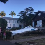
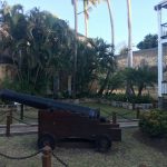
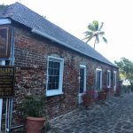
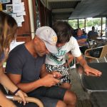
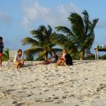
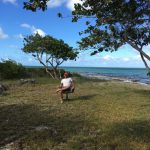
After the clearing-in ritual, the crew could land and we all took a walk to visit Nelson’s Dockyard under the setting sun. The site is interesting because the old buildings have been restored and the entire area is a journey back in time. Only the British navy vessels are missing, but a J class and Jolly Roger (a two mast shooner built by the Swedish navy in 1944) were there. One can imagine the buzz there during the Antigua Sailing Week, but at the time of our visit it was really quiet, we thought we saw the phantoms of the armed guards and headed back to Keraban for dinner.
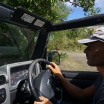
The following day we rented a car to tour the island. We took a Jeep Wrangler, for which I admit I have a weakness, and drove the roof down until the first squall hit. Unlike Europe, here they come equipped with an 8 cylinder block, not a soul less diesel. You also get to pass a difficult exam for your Antigua & Barbuda drivers license (will show it back at home next time they stop me “cusa l’è sta roba”): I still manage to spin the wheels and even to drive on the wrong side of the road.
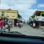
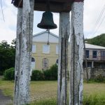
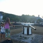
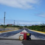
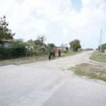
We followed a clockwise direction, stopping in the SW at Cade’s Bay, Jolly Harbor and St. John in the morning. St. John is the largest Caribbean town we have seen so far (20,000 inhabitants). It is very lively, a mixture of old and new, Caribbean decadence (in the positive sense of the word) backed by some infrastructure to host the large cruising ships. Indeed, the harbor has a large dock dedicated to cruising ships, with a shopping mall featuring anything you can imagine in terms of luxury branded goods, quite a contrast to the traditional town that extends barely 50 meters from there. As we did want a quieter place for lunch, we stopped a few miles down in a roadside restaurant and then headed for Dickenson Bay and Non Such Bay, while passing by a very large cricket stadium and, believe it or not, a drag racing strip. Anyway, our Jeep was gobbling gasoline as if it were rum, and with the gas tank showing “E” we reached Shirley Heights, which oversees English and Falmouth Harbors. This fort was used to protect the strategic enclave, and to spot potential threats arriving from sea through a flag based communication standard. The visit is worthwhile, both culturally and because of the views.
But it was time to drive down, as more urgent matters awaited. FC Barcelona was playing PSG at the Champions and we were getting updates over the cell, 3 to nil for Barça as we dropped the car, but 3-1 as we reached the sports bar with the TV screen, and with only 15 minutes to go. It seemed all was over. The events that followed are in the history books, and the scream that Gianluca managed when the score showed 6-1 disturbed more than one gentleman sailor….(for the record, I was born and grew up in Barcelona).
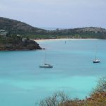
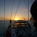
Our original purpose was to spend most of our time at Antigua in Nonsuch Bay, which is a reef protected bay to windward, not unlike the Tobago Cays. The key part is the entrance to the bay, which is an S shaped channel between reefs. Not a particularly tricky one, but the seas had built up during 1 week of sustained 25-30kn trade winds, and as we ventured out of Falmouth we had 3-4m of E-NE swell. Our friends Talitha and Wind4Life which had arrived there a couple of days ahead were out of VHF range and we could not remotely check the channel’s conditions. The options were to sail to windward and check the entrance channel to Nonsuch bay, potentially being forced to make a U-turn (or head straight to Barbuda, some 45nm North) if conditions were tricky, or to call it a miss and sail up the West coast.
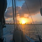
Rightly or wrongly we gybed and headed up the East coast towards Deep Bay. Most likely not as nice as Nonsuch, but very pleasant nevertheless, well protected from swell and on that day with only 1 boat at anchor. You have to watch out for the wreck that lies right in the middle of the entrance (in some charts on the north side, on others on the south side). As far as I recall from reading, the wreck is a cargo that sunk in 1905 or so. It had an inflammable load that had become unstable. The St. John’s port authority refused the entrance and the boat anchored at Deep Bay. When the crew went to check the load and opened the hatch, the air influx allowed for the chemicals to catch fire, and that was that. Anyway, better get closer to the south side of the bay if you make a night entrance.
We stayed there a couple of nights, enjoying the quiet area. Gianluca got to windsurf for 3 days in a row and I gave it my first try since the back pain in Martinique a month ago. We also hiked up the hill to visit the fort that served as an observation point.
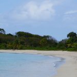
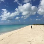
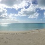
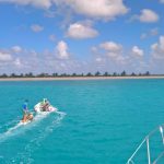
Barbuda was, up until a few days ago (speaking real time), an unknown. We were not even sure we were going to get there as the words “incompletely surveyed” “numerous uncharted coral heads” and “put a crew on the rig at all times” abound on the chart. What a mistake would that have been! I am not going to describe our stay in Barbuda, simply because I am not good enough to convey the beauty and feelings that place impressed on all of us.
Get on a boat and get there is the only advice I can give you, it is paradise and just for you, out of the route of 99.9% of cruisers and charters. And yes, really put someone at the bow, and even better on the rig.
On aura l occasion de sortir avec le First j espere. Aux BVI en ce momment. On fini en beaute. Tentes par le Puerto Rico, mais le retour a st. Martin au pres serait bjen long.

Ca donne envie; heureusement que le printemps arrive ici et le First 30 jk est à l’eau 🙂
On aura l occasion de sortir avec le First j espere. Aux BVI en ce momment. On fini en beaute. Tentes par le Puerto Rico, mais le retour a st. Martin au pres serait bjen long.
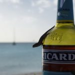
La bouteille de Ricard (de Talitha) a scellé vos amitiés..
Bonne continuation dans ces merveilleux paysages
Le papa de Nathalie